International Disaster Risk Reduction Day: Why being prepared is key to overcoming 21st century challenges
The novel coronavirus disease (COVID-19) pandemic couldn’t have come at a worst time.
Many countries were already struggling to cope with rising numbers of climate-related disasters when the virus emerged and began to spread, overloading medical services, causing mayhem for food production and sending national economies tumbling.
Still ongoing, it has highlighted vulnerabilities in everything from emergency response to global supply chains and raised questions about how we might manage our world better in the future.
The focus on governance of this year’s International Day for Disaster Risk Reduction (IDDRR) therefore seems particularly poignant. In recent years, each IDDRR has promoted one of the seven targets of the Sendai framework.
This year, the focus is on Target E: to ‘substantially increase the number of countries with national and local disaster risk reduction strategies’. The main message is that many disasters can be avoided or prevented if robust disaster risk reduction strategies are in place.
Hi-tech planning
At the International Water Management Institute (IWMI), this message is very close to our hearts. In the Water Risks and Disasters research group that I lead, we apply the latest satellite technology to help national and state governments, non-profits and specialist agencies to plan for and reduce the risk from, disasters.
Our work is primarily focused on reducing risk from climate-related shocks such as droughts, floods and biological pest attacks. These often have a huge impact on the livelihoods of smallholder farmers in Africa and Asia, many of whom are poor and vulnerable.
Since 2014, we have worked to develop the South Asia Drought Monitoring System. The system has three components:
- A weekly map of drought conditions encompassing indices for rainfall, soil moisture and drought severity, which helps authorities to forecast forthcoming drought risk;
- A risk and vulnerability assessment that can inform the design of well-targeted policies and programmes before droughts occur;
- A mitigation and response plan, which is enacted when a drought is evolving.
The system, which won the Geospatial World Excellence Award 2020, has frequently guided national, state and district-level authorities in India and Sri Lanka to take timely action to prepare for drought.
Our innovative satellite index-based flood and drought insurance scheme, meanwhile, is designed to transfer risk from farmers and underpin food security. The system is based on indices of risk for floods and droughts compiled using historic climate records and data on vulnerability.
When an extreme event takes place, the technology enables insurers to determine the depth and duration of a flood or the extent and severity of a drought, so they can quickly verify and pay smallholders.
We are currently investigating using similar technology to reduce risk from infestations by pests such as locusts, which can eat the food of thousands of people in one day.
At a river-basin scale, we are pioneering a way to increase groundwater available to farmers, while minimising the impacts of floods. The process, described as Underground Taming of Floods for Irrigation, involves increasing the volume of water that infiltrates into underground aquifers during the wet season and extracting it for irrigating crops during the dry season.
A study undertaken by IWMI in 2020 has identified river basins in India, Ethiopia and Thailand as having high suitability for this approach. More detailed investigations are planned to identify optimal ways for implementing UTFI.
Managing multiple shocks
The COVID-19 pandemic has made it abundantly clear, however, that it is not enough for authorities to prepare for single disasters.
There have already been several instances where a natural disaster has occurred concurrently with the pandemic, forcing governments to confront the dual challenges of evacuating people while trying to enforce social distancing.
For example, residents of several towns on lockdown in Spain needed rescuing from flash floods just as the country reached the peak of its COVID-19 outbreak in early April.
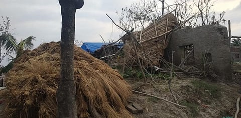
In May, IWMI scientists spotted super cyclone Amphan evolving in the Bay of Bengal headed towards crowded coastal areas of West Bengal in India and Bangladesh.
They reacted quickly to supply satellite-based maps, which helped authorities locate and evacuate vulnerable people and identify damaged infrastructure and agriculture. By the time the cyclone struck land, millions of people evacuated in West Bengal and Bangladesh had been moved to the safety of 12,000 shelters.
The pandemic shows no sign of abating and the frequency of climate shocks is set to continue rising; in the last four decades, the frequency of natural disasters recorded in the Emergency Events Database (EM-DAT) has increased almost three-fold, from over 1,300 events in 1975–1984 to over 3,900 in 2005–2014.
If countries are to minimise the costs from the unprecedented challenges this situation presents, they must place disaster-governance at the heart of their social, economic and development planning. Being prepared for any eventuality is key to saving lives, strengthening economies, and enhancing people’s livelihoods and wellbeing.
Giriraj Amarnath is Research Group Leader, Water Risk to Development and Resilience (WR2DR), at the International Water Management Institute


