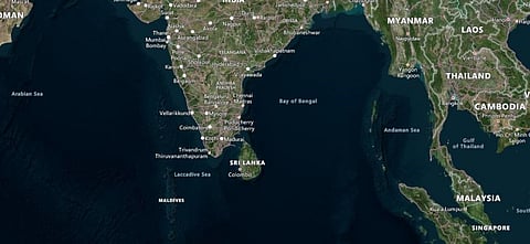

Cyclone Gulab, which made landfall on the eastern coast of India on the night of September 26, 2021, might achieve a rare feat in the next few days.
It might travel as a low-pressure area across the width of peninsular India and re-emerge in the Arabian Sea, according to data from the Global Forecasting System (GFS) of the United States as represented in the website Earth Null School.
The India Meteorological Department (IMD), confirmed this in its latest update September 27:
The system is likely to emerge into northeast Arabian Sea and adjoining Gujarat coast around September 30 evening and there is likelihood for the system to further intensify over northeast Arabian Sea during the subsequent 24 hours.
Gulab is currently moving at a brisk pace across Andhra Pradesh and Telangana, causing significant rainfall along the way.
Cyclone Tauktae, that hit Gujarat in May, had also travelled long distances after landfall and maintained its strength as a cyclone for close to 18 hours. It had then de-intensified into a low-pressure area and reached as far inland as Delhi.
Once Gulab reaches the waters of the Arabian Sea, it might regain strength to become a cyclone with significant strength but a lot of uncertainty remains with these forecasts.
GFS data showed that the system might cross into the Arabian Sea close to Surat and then skirt the Saurashtra coast before moving further and intensifying.
This might cause tremendous volume of rainfall over the Saurashtra region, which has already received heavy rainfall due to the various low-pressure systems that formed throughout September.
The Joint Typhoon Warning Centre (JTWC) of the United States Navy also predicted a similar path as GFS for Cyclone Gulab in its last update on the system.
It said the energy associated with the system would be enough to carry it across the distance of approximately 1,600 km.
It added:
There is great uncertainty where precisely the vortex might re-emerge into open waters and the intensity at which it might do so, so JTWC will continue tracking the system but forego warnings until such time as conditions warrant.
September is not usually a month in which cyclones form as the southwest monsoon season is in its withdrawal phase.
Only 50 cyclones formed in September between 1891 and 2020, as against 124 in October and 145 in November, which are the main cyclone generating months, according to data from the IMD.
Of the 50, 41 formed in the Bay of Bengal and nine in the Arabian Sea. There have been 11 cyclones in September since 1975, when satellites started monitoring weather phenomenon.
Six were in the Bay of Bengal and five in the Arabian Sea. Gulab might have the distinction of being counted as forming over both seas.
The cyclones that do form don’t have much strength. In fact, in the last 20 years (2002-2021), only six cyclones have formed in the month of September in the Bay of Bengal and Arabian Sea.
Cyclone Gulab is the third September cyclone that formed in the Bay of Bengal. It is also the third cyclone to make landfall.
The lowered strength of September cyclones is mainly because of lower sea surface temperatures and unfavourable wind shear, according to The Weather Channel, a website operated by IBM.
But Cyclone Gulab seems to have formed and is propagating despite the unfavourable conditions.
“This system could be the result of a predominant easterly wind in the subtropics, which usually happens in October,” Atsushi Okuro, senior meteorologist at The Weather Company (also run by IBM) told The Weather Channel.
He added:
As the southwest monsoon is still active, the subcontinent should be widely covered with southwesterly or westerly winds, thus making it difficult for such systems to hit from east to west.
He further portended that the formation and propagation of Cyclone Gulab might be because of weaker southwesterly winds this year. This may also be the cause for its possible travel for thousands of kilometres.