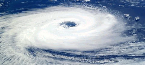

The India Meteorological Department (IMD) has predicted the formation of a low-pressure area in the south Andaman Sea on April 30, 2020. It has issued two press releases in this regard on April 26 and April 27.
IMD forecasts that the low-pressure area, which is the first stage of formation of a cyclone, will likely intensify into a depression by May 2, while moving in the north and northwest direction along the Andaman and Nicobar Islands at first, but then changing direction to move towards the Myanmar coast.
This will bring light-to-heavy rainfall in most parts of the Andaman and Nicobar islands from April 30 to May 3. The sea conditions in the region will be rough in this period and IMD warns fisher folk to not venture out onto sea.
In late April 2019, Cyclone Fani had formed as a low-pressure area in the south Bay of Bengal and ended up as an extremely severe cyclone which devastated large parts of coastal and inland Odisha.
There was also Cyclone Vayu in June. IMD has not stated in its press release if the depression will further intensify into a deep depression or a cyclone or if it will de intensify.
It does state that “the system is under continuous surveillance and the concerned state governments are being informed regularly.”
Although cyclones in the pre-monsoon season are not unheard of, there are some anomalous wind patterns in the Indian Ocean region which might be influencing the formation of low-pressure areas and depressions which eventually strengthen into cyclones.
It might even impact the coming south west monsoon season.
“It is clear that the southeasterly winds south of the equator are weaker than normal. These winds are important for picking up moisture and bringing it across the equator over the Arabian Sea in the low-level jet over to India,” Raghu Murtugudde, climate scientist at the University of Maryland, said.
“The low-level jet over the Arabian Sea is also not well formed and weaker than normal. Unfortunately, land has also been cooler than normal since January which means the cooler land-warmer ocean is unfavourable for the monsoonal circulation,” he added.
This means that the vertical shear or the change in winds from the surface to the upper atmosphere is weaker than normal. This shear is what suppresses cyclones.
Last year, the monsoon onset in many parts of India was delayed by three weeks, which means the shear was weak and favoured cyclone formation into June. This resulted in the formation of cyclone Vayu in June which is unusual for the monsoon season.
There was a depression in the eastern Pacific Ocean, which is being described as the earliest (time of the year) depression ever for that part of the ocean. Another major depression will also form soon off the coast of the Philippines, according to data from the Global Forecasting System of the United States.
“There are very warm sea surface temperatures in the western Pacific and the eastern Pacific. So, they should favour the growth of tropical depressions,” Murtugudde said.
What links the Bay of Bengal, west Pacific and the east Pacific is the ITCZ - Inter Tropical Convergence Zone.
“If it shifts, it can create coherent warm sea surface temperature anomalies and vertical shear anomalies from the east Pacific into the Bay of Bengal even though the Bay of Bengal this time does not have the ITCZ,” Murtugudde said.
The ITCZ over the Indian Ocean is to the south of the equator and it wants to shift north as the sun moves across the equator in March. “But the warm ocean keeps the ITCZ and the low-pressure systems coming across the equator into the Bay of Bengal,” he added.